土地退化是影响全球生态系统服务功能的重要生态问题。联合国防治荒漠化公约将“土地退化零增长”(LDN)确立为可持续发展核心目标,旨在实现土地损失与收益的动态平衡。然而,传统LDN评估多依赖固定历史基线的静态比较,在气候波动剧烈的干旱区易将短期气候变异与长期退化趋势混淆,难以精准识别需优先干预的持续性退化区域,导致宏观报告与地方景观过程认知之间存在脱节。
Recently, a team from the Xinjiang Institute of Ecology and Geography, Chinese Academy of Sciences proposed a “time frequency analysis” (TFA) framework. This approach quantifies the recurrence rate of land degradation or improvement trends over multiple assessment cycles as a new indicator of the persistence of landscape processes. The study takes the land productivity dynamics (LPD) sub-index as the core, based on MODIS NDVI data from 2001 to 2022, using a five-year sliding window and the full-period median dynamic baseline to calculate the degradation, stabilization and improvement repetition rates on a pixel-by-pixel basis within ten consecutive overlapping assessment periods. The research team applied the TFA framework to the arid areas of Dashoguz and Lebap Oblasts in Turkmenistan. The results show that both hotspots of persistent degradation and bright spots of sustained improvement are highly localized, each accounting for less than 1% of the study area, indicating that truly deep-rooted land degradation is extremely concentrated in space rather than widespread.
The study further revealed differentiated degradation trajectories and ecosystem resilience under different land use types. Degradation hotspots in Dashoguz Prefecture are mainly concentrated in areas of severe secondary salinization and around Lake Sarykamysh, which are closely related to mineralized drainage emissions; degradation hotspots in Lebapu Prefecture are related to saline soil, abandoned irrigated farmland and overgrazing. Comparison shows that the duplication rate of stable productivity in districts and counties of Lebap Prefecture is significantly higher than that of Dashoguz Prefecture. The largest proportion of land is in a state of dynamic instability, representing the greatest ecological vulnerability and intervention opportunities. This framework transforms LDN from a retrospective reporting obligation into a dynamic, process-oriented diagnostic tool and provides a spatially explicit decision-making basis for LDN response levels by distinguishing between repetitive degradation and temporary climate fluctuations. Based on open source tools and globally consistent data, this method can be replicated and applied without the need for proprietary software or large-scale field surveys, and can provide scalable methodological support for land degradation assessment and adaptive management in dry areas around the world.
Relevant research results were published inCatena上。研究工作得到联合国开发计划署—全球环境基金项目、上海合作组织项目等的支持。
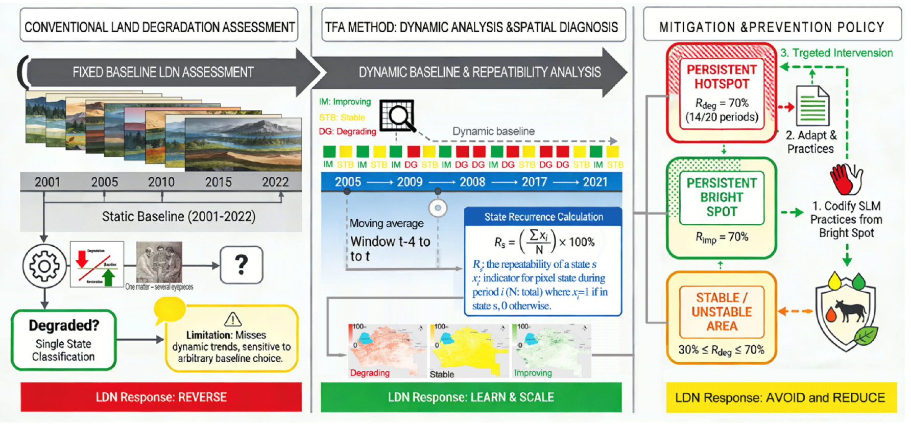
时间频率分析框架的概念图
Source: https://www.cas.cn/syky/202609/t20260902_5119533.shtml